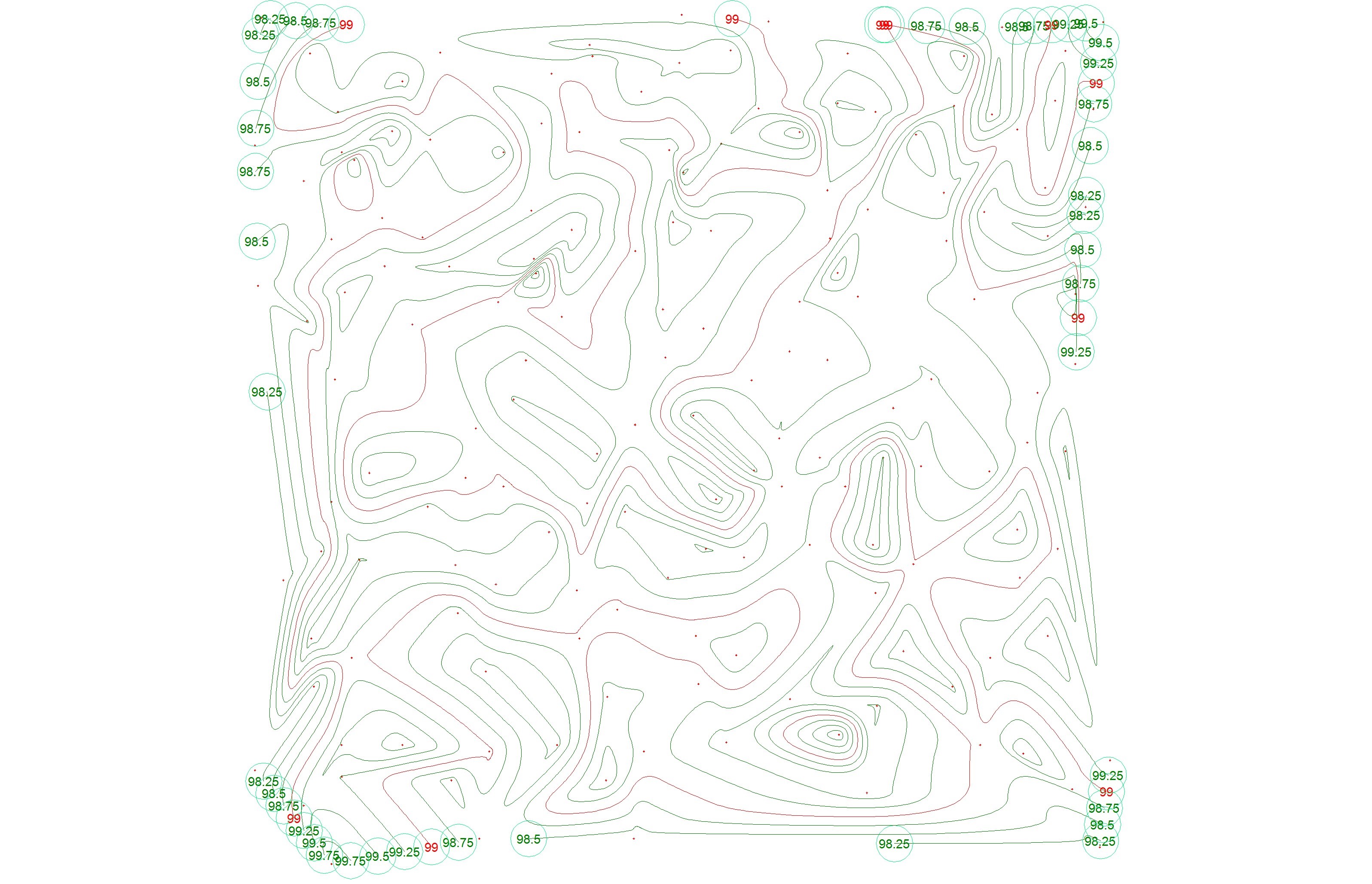
Contour
-
DTM (Digital Terrain Model):
- Perform triangulation and contour generation, including annotated contour drawings.
- Apply inner and outer boundaries to contours.
Volume Calculation Between Two Layers
(Two Point Groups)
-
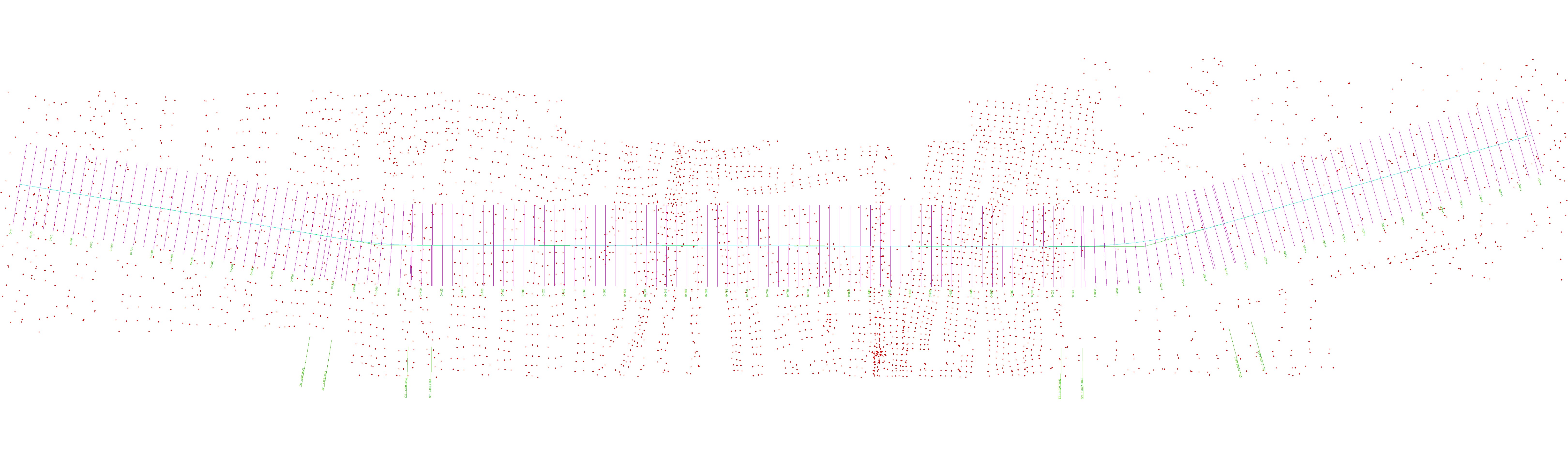
Strings:
- Import data from files or the CAD interface, with the ability to edit directly within CAD.
- Assign line types and hatch patterns.
- Volume Calculation between surveyed surfaces:
- Utilize grid, cross-section, or triangulation methods for volume calculation, including drawings depicting initial and final stages, average RLs, and cut/fill quantities.
-
Process codes:
- Generate survey drawings based on predefined codes.

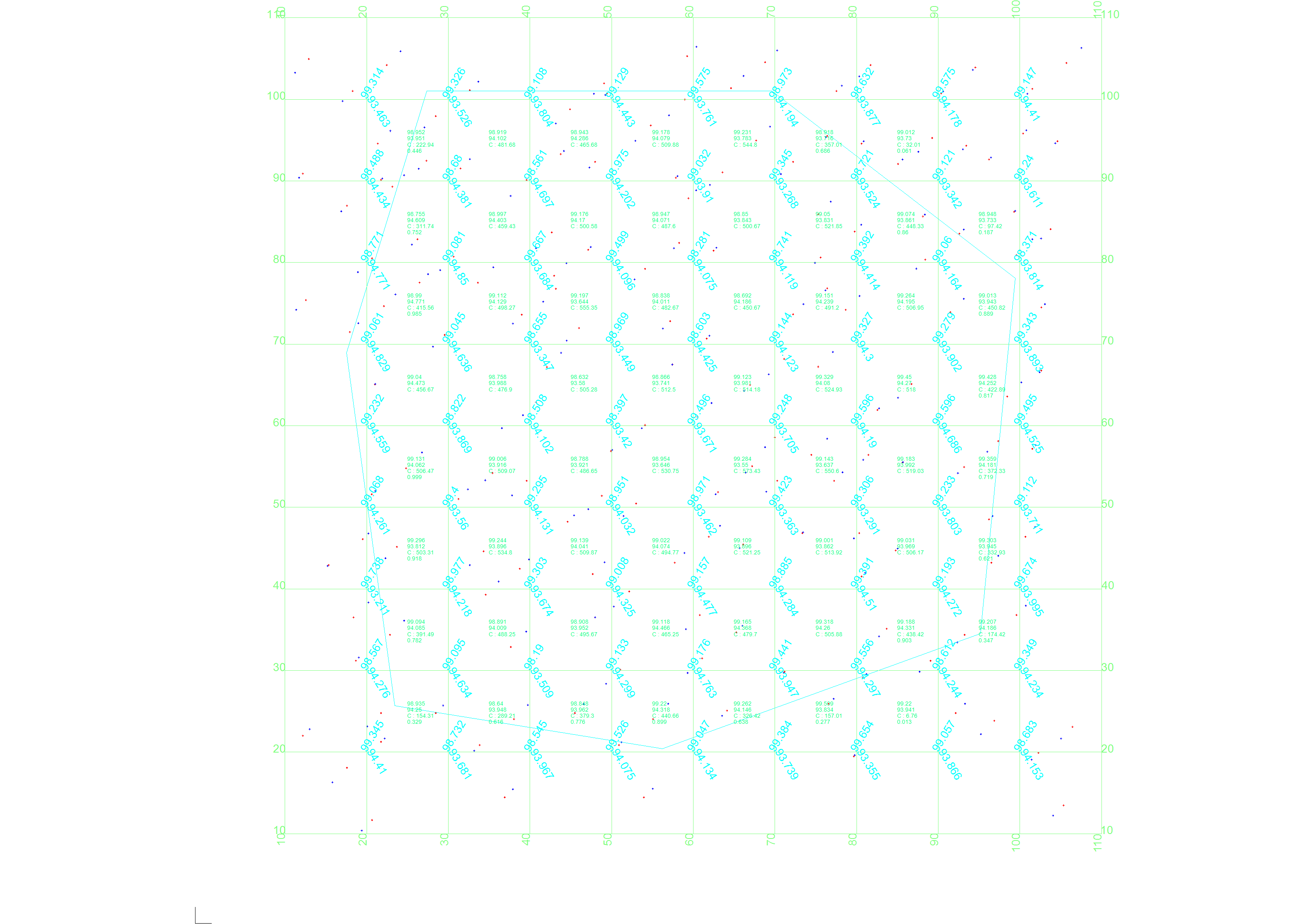
Point With RL Data
-
Point Groups:
- Import data from files, CAD points, or blocks.
- Directly create points within the CAD interface.
- Convert random points to a grid format based on triangulation.
HIP Data
-
Horizontal and Vertical Alignments:
- Define alignments with multiple points, including curves for geometric design.
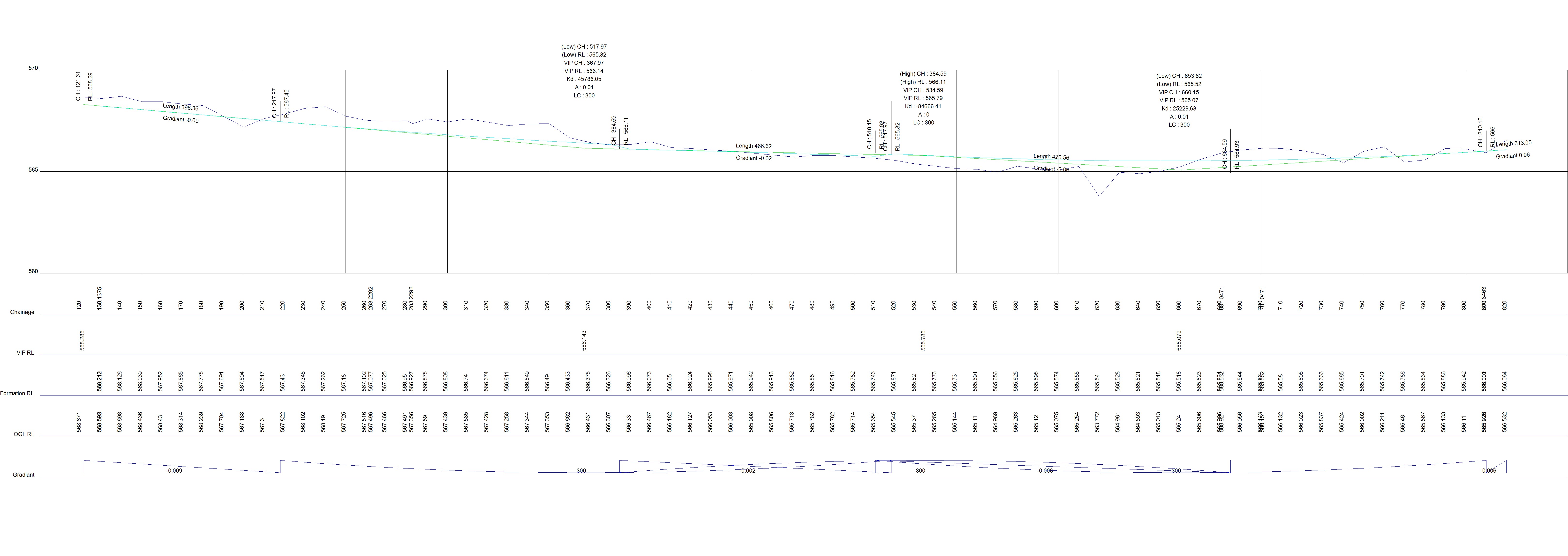
VIP Data (L-Section)
-
L-Sections Drawings:
- Produce drawings illustrating L-sections for comprehensive land development visualization.
- Our tools streamline land development processes, offering robust features for surveying, contouring, volume calculation, alignment design, and drawing generation.